Within the Latin American and Caribbean region, it has been recorded that at least 25% of the population lives in informal settlements. Given that their expansion is one of the major problems afflicting these cities, a project is presented, supported by the IDB, which proposes how new technologies are capable of contributing to the identification and detection of these areas in order to intervene in them and help reduce urban informality.
Satellite Imagery: The Latest Architecture and News
The Use of Artificial Intelligence as a Strategy to Analyse Urban Informality
Losing Scale: Airports Seen from Above
At different periods in history, the human scale and the approach of the building to the sensitive dimension correlated to the body were values pursued by the architects and an object of reflection for the theoretical production of the area. Although it is a virtue that a space can be perceived in a direct relation between the person and the building, there are cases, and more than that, some project scales, that can only be realized from the furthest perspective.
How We Change the Earth: Human Transformations on the Planet as Seen from Above
Human impacts on Earth are a common issue nowadays, and many people say that there is no turning back. Climate crisis, greenhouse gases, exploitation of natural resources, production of solid waste and atmospheric pollution are some of the most pressing issues that the global community must address if we want to ensure a sound future for the next generations.
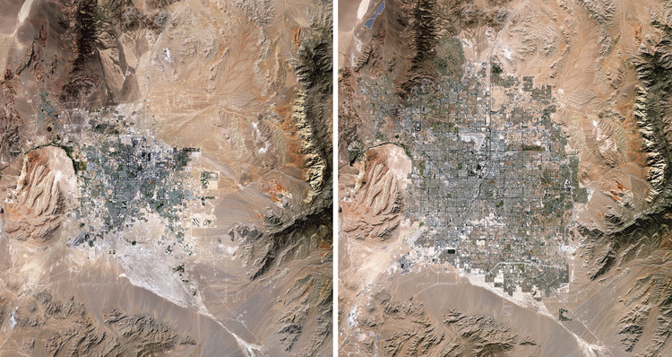
These topics can be viewed in full-color and high-definition in the new book Overview Timelapse: How We Change the Earth, by Benjamin Grant and Timothy Dougherty, which compiles 250 satellite and drone photographs of places on Earth that are in constant transformation.