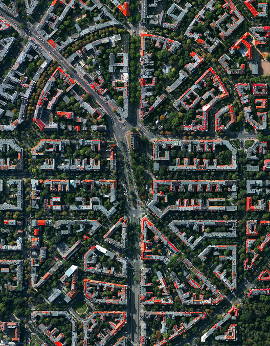
As recently as a century ago the idea of viewing the world from above was little more than a fantasy: the airplane was still in its infancy, with rocketry and satellites still decades into the future. Those who could not take to the air had no recourse but drawing in order to represent their world from an aerial perspective. This limitation is difficult to imagine today when access to plan photography is never further than the nearest Internet connection. Anyone with a smartphone has, in essence, the entire world in their pocket.

What do we do with this power? In becoming a civilization capable of producing these databases, we have increasingly altered the Earth to better suit our needs. The images which satellites produce do not reflect unspoiled wilderness: cities and roads sprawl ever further across the landscape, a clear visual indicator of humanity’s increasing impact on the planet. While plan drawings show us an idea of the future, plan photographs capture change which has already been realized – for better or for worse.
With this in mind, a more pertinent question arises: what does this power compel us to do? Daily Overview posits that it is not enough for us to simply admire the novel aesthetics of satellite imagery. This medium is a chance for us to both marvel at the beauty we have created in the world, and that which we have destroyed. It forces us to comprehend the magnitude of our responsibility to preserve and protect the planet we call home.
With the right frame of mind, satellite imagery can become an instrument for planning in itself – one which will display the consequences of our actions without hesitation or apology. Satellites may not be able to capture images of that which has yet to be, but they can provide us with the inspiration needed to plan civilization’s future with the preservation of the Earth in mind.


You can follow the Daily Overview on Instagram here, or check out their other social streams.
Contemplating Humanity's Effect On Planet Earth, From Above
The Power Of The Plan: Drones & Architectural Photography
Daily Overview's satellite imagery is courtesy of DigitalGlobe.

