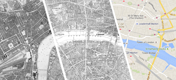
It's no secret that architects are often fascinated by maps, and in the age of Google - where access to accurate maps of almost anywhere in the world has become universal - maps have become one of the most powerful ways to understand our cities. Interestingly, Google has in a way enabled a new way to interrogate maps from the past, as historic maps can be more easily overlaid with the Google interface to make comparisons to the present day. That's just what the website Locating London's Past has done, creating a tool to compare three maps: the current version of Google Maps, the first Ordnance Survey map from 1863-80, and John Rocque's 1746 Survey of London, allowing web users to see the growth of the UK capital over the past 270 years.

Besides the visceral fascination of finding out what used to happen at your home or favorite bar, historical maps can be an invaluable resource for studying urban history, and Locating London's Past does not disappoint in this regard. The website's database includes a wide variety of historical records, from census data to crime records to a record of plague deaths - and many of these events can be mapped to the historical fabric of the city. In the map above, for example, addresses taken from a 1774 directory reveal how the South Bank became occupied much more gradually than the City of London in the north, initially growing from what is now the A3 on the west and Tooley and Bermondsey Streets on the east.
Check out the website here and start investigating London's built history for yourself.

